We promote an environment where people and projects succeed.

Geographic Information Systems

Geographic Information Systems (GIS) technology

Geographic Information Systems (GIS) implementation and data management are integral to the execution of complex projects in the energy industry.
Merjent’s team employs the latest in GIS and Global Positioning Systems (GPS) technologies to meet client needs. Our services include spatial analysis; web mapping; cartographic products; and field data collection, reporting, and management.
  • The GIS team analyzes complex geospatial datasets to support project decision-making processes. Merjent integrates reputable public datasets, field survey data, and private client information to create defensible analyses for project reporting purposes. Our work helps reduce impacts on the environment and neighboring communities. We use ESRI’s ArcGIS suite of software products to provide a variety of spatial analysis services.

    Spatial Analysis Services:

    • Corridor evaluation/analysis
    • Project and facility siting
    • Impact and constraint analysis
    • Data tabulation and summary
    • Light Detection & Ranging (LiDAR) interpretation and classification
    • Feasibility studies
    • Alternatives evaluation
    • Qualitative & quantitative raster and vector analysis
    • Customized data analysis tools
    • Permit application support
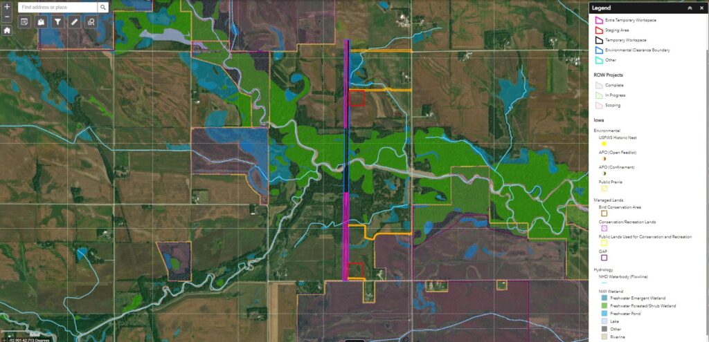
  • Merjent’s GIS Specialists provide web mapping capabilities that will greatly improve coordination among multifaceted project teams. Merjent’s user-friendly mapping platforms will improve project coordination and analysis.

    Web Services Include:

    • environmental inspection reporting
    • user friendly analysis of public and internal data products
    • real-time updates of field data and project features
    • feature creation and editing
    • customizable user interface
    • tracking through relational databases
    • integrated tools for analysis
  • Merjent provides the traditional mapping services that clients are accustomed to. We quickly and efficiently compile maps and datasets that meet client/agency requirements and expectations.

    General Mapping Services Include:

    • Computer Aided Drafting (CAD) Integration
    • cartographic layout design
    • Enterprise geodatabase creation and management
    • typical construction illustrations
    • plan and profile cross-sections
  • We have developed advanced, user-friendly database systems that continually deliver data to project staff for review through web-based secure portals or simple desktop applications. The GIS team uses GPS/GNSS technology (Trimble GeoXTs and R1 receivers) in the field to provide high quality and accurate data products for applicant submittals. The team integrates this with office resources to create a seamless transition of field data into useable products for engineers, project managers, and permitting staff alike.

    Field Services Include:

    • biologicalwetlands, and cultural resources survey management
    • custom survey data dictionaries
    • field and office staff collaboration
    • Field Maps for ArcGIS and Survey123
    • online survey status tracking
    • daily progress reports/survey permission coordination
    • GPS data processing (Terraflex/Terrasync)
    • Fulcrum Field Data Collection App
      • Field to Office Workflow
      • Dashboard View with Analytics
      • GIS Integration
      • Online/Offline compatible

Contacts

Kyle Solberg
GIS Coordinator
kyle.solberg@merjent.com