
Merjent’s Wetland and Aquatic Services Team partners with clients to help them successfully develop, design, permit and monitor projects – from small-scale land development to large-scale, multi-state, linear construction- using the latest Geographic Information System (GIS) technology, Global Positioning System (GPS) equipment, water testing equipment, appropriate survey methodologies and data reporting and management technology solutions.
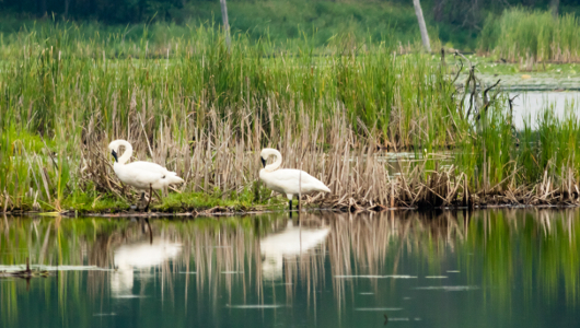
Our team has extensive experience assessing wetlands through desktop review and on-site determinations and delineations. Our aquatic services team can perform a wide range of biological surveys, physical, chemical and habitat assessments, water quality monitoring and compliance support at all stages of a project.
Desktop reviews are conducted at the start of any project and use aerial imagery and any other readily available data sources (including soils, hydrology, land cover, wetland inventory). Our team then develops permitting strategies appropriate for the size and scope of your project to avoid, minimize, and mitigate impacts.
Depending on project size and level of effort, we either manage and coordinate field efforts or send individuals from our team of ecologists to conduct quick turnaround surveys, whether a determination, delineation, or functional assessment is required.
Following wetland data collection, our team works with federal, state, and local agencies, on behalf of our clients, to navigate the regulatory process and develop necessary permit applications. We often engage in Section 401/404 consultations under the Clean Water Act.
The permitting process may result in mitigation or post-construction wetland monitoring requirements. Our team can help manage, coordinate, and supply personnel to support such needs.
Comprehensive aquatic surveys on freshwater ecosystems including freshwater mussel presence/absence surveys, relocations, and monitoring; fish community assessments, monitoring, and targeted species collections; macroinvertebrate community assessments and monitoring; and water quality sampling, analysis, and monitoring.
Zach Waechter